
Hotels
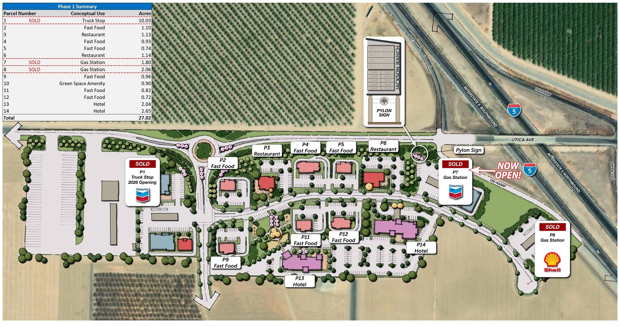
Two hotel parcels of 2.04 and 2.65 acres, at the interchange and within walking distance of the planned restaurants and green space.
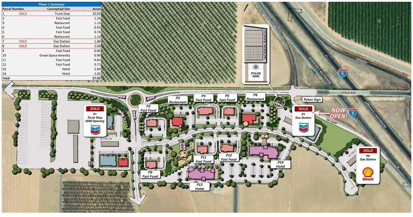
Phase 1 is 27.02 acres of highway commercial land at the Interstate 5 and Utica Avenue interchange, planned for hotels, restaurants, quick service, general retail, a truck stop and an open green space amenity. 12.23 acres remain available.
See what is availableRemaining available
12.23 ± AC
Phase 1 parcels are delivered in a rough graded condition, with all utilities stubbed and all off-site work completed. The Chevron and Shell stations are built and operating, and the truck stop parcel is sold.
Parcel sizes run from 0.72 to 10.03 acres. Uses shown on the plan are conceptual; discuss your own requirement against the approvals for the parcel.
| Parcel | Conceptual use | Parcel size | Status | Inquiry |
|---|---|---|---|---|
| P1 | Truck stop | 10.03 ± ac | Sold | Not available |
| P2 | Fast food | 1.10 ± ac | Available | Inquire about P2 |
| P3 | Restaurant | 1.13 ± ac | Available | Inquire about P3 |
| P4 | Fast food | 0.93 ± ac | Available | Inquire about P4 |
| P5 | Fast food | 0.74 ± ac | Available | Inquire about P5 |
| P6 | Restaurant | 1.14 ± ac | Available | Inquire about P6 |
| P7 | Gas station | 1.80 ± ac | Sold Chevron, now open | Not available |
| P8 | Gas station | 2.06 ± ac | Sold Shell, now open | Not available |
| P9 | Fast food | 0.96 ± ac | Available | Inquire about P9 |
| P10 | Green space amenity | 0.90 ± ac | Not for sale | Not available |
| P11 | Fast food | 0.82 ± ac | Available | Inquire about P11 |
| P12 | Fast food | 0.72 ± ac | Available | Inquire about P12 |
| P13 | Hotel | 2.04 ± ac | Available | Inquire about P13 |
| P14 | Hotel | 2.65 ± ac | Available | Inquire about P14 |
Prepare a draft now, then call or email Roy Belson to arrange a first call.
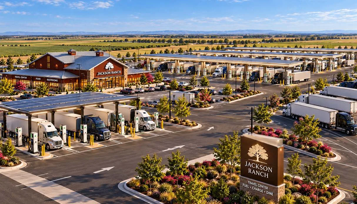
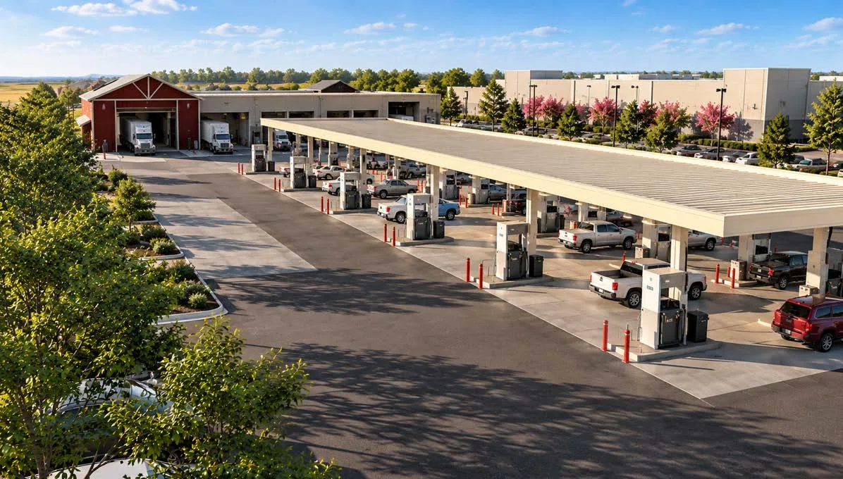
The commercial area is planned as a travel centre rather than a truck stop alone, with attractive off-site landscaping and highway pylon signage at the interchange.
Two hotel parcels of 2.04 and 2.65 acres, at the interchange and within walking distance of the planned restaurants and green space.
Two sit-down restaurant parcels and six quick-service parcels, sized from 0.72 to 1.14 acres.
A 10.03-acre truck stop and two gas station parcels, all three sold. Chevron and Shell are both trading today.
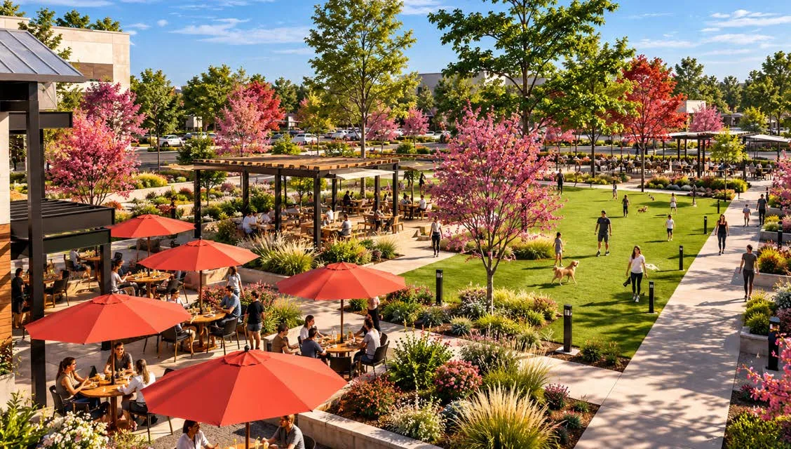
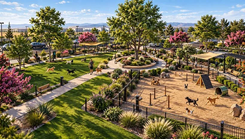
A 0.90-acre open green space amenity at the centre of the commercial area, for travellers and for the people working here.
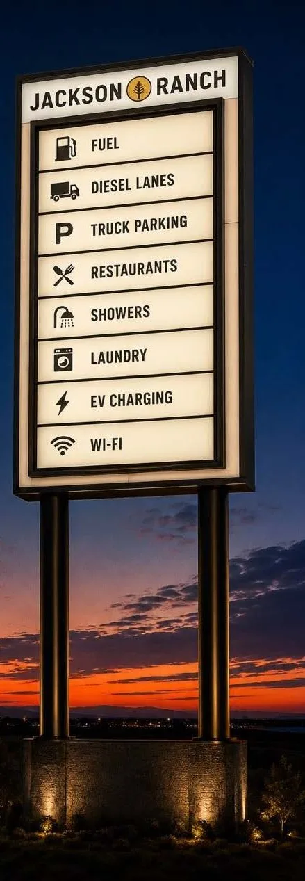
An illuminated 100-foot multi-tenant pylon sign is approved for the interchange, carrying eight larger tenant panels above six smaller ones. It is designed to be read at highway speed from both directions.
The design is conceptual. Panel allocation is part of the conversation about a parcel.
Jackson Ranch sits roughly halfway between San Francisco and Los Angeles. Apart from Kettleman City four miles north, the nearest comparable travel centre is at Lost Hills, 27 miles south.
| Travel centre | Route | Distance |
|---|---|---|
| Kettleman City | Highway 41 | 4 miles north |
| Lost Hills | Highway 46 | 27 miles south |
| Buttonwillow | Highway 58 | 48 miles south |
| Tejon Ranch | Laval Road | 86 miles south |
Distances along Interstate 5 from the Utica Avenue interchange (exit 305), taken from the exit numbers, which California assigns by milepost. Travel centres named in the 2026 marketing brochure.
Prepare a draft now, then call or email Roy Belson to arrange a first call.